
.jpg)
Possible areas
Six Community Plan Areas help residents discuss places. They are not a legal or property-by-property city boundary.
Conceptual map · all lines unresolved
Explore areas people may have in mind, keep LAX and the western hills unresolved, see how current services cross any future line, and review the questions a real boundary decision would have to answer.
City of Westside is an exploratory civic initiative, not an existing city, government agency, ballot measure, service provider, emergency service, or official source. Every map is illustrative, not a legal or official property-by-property boundary. Photography shows local places; it does not prove that an area belongs in a city.
Place context / local licensed photography
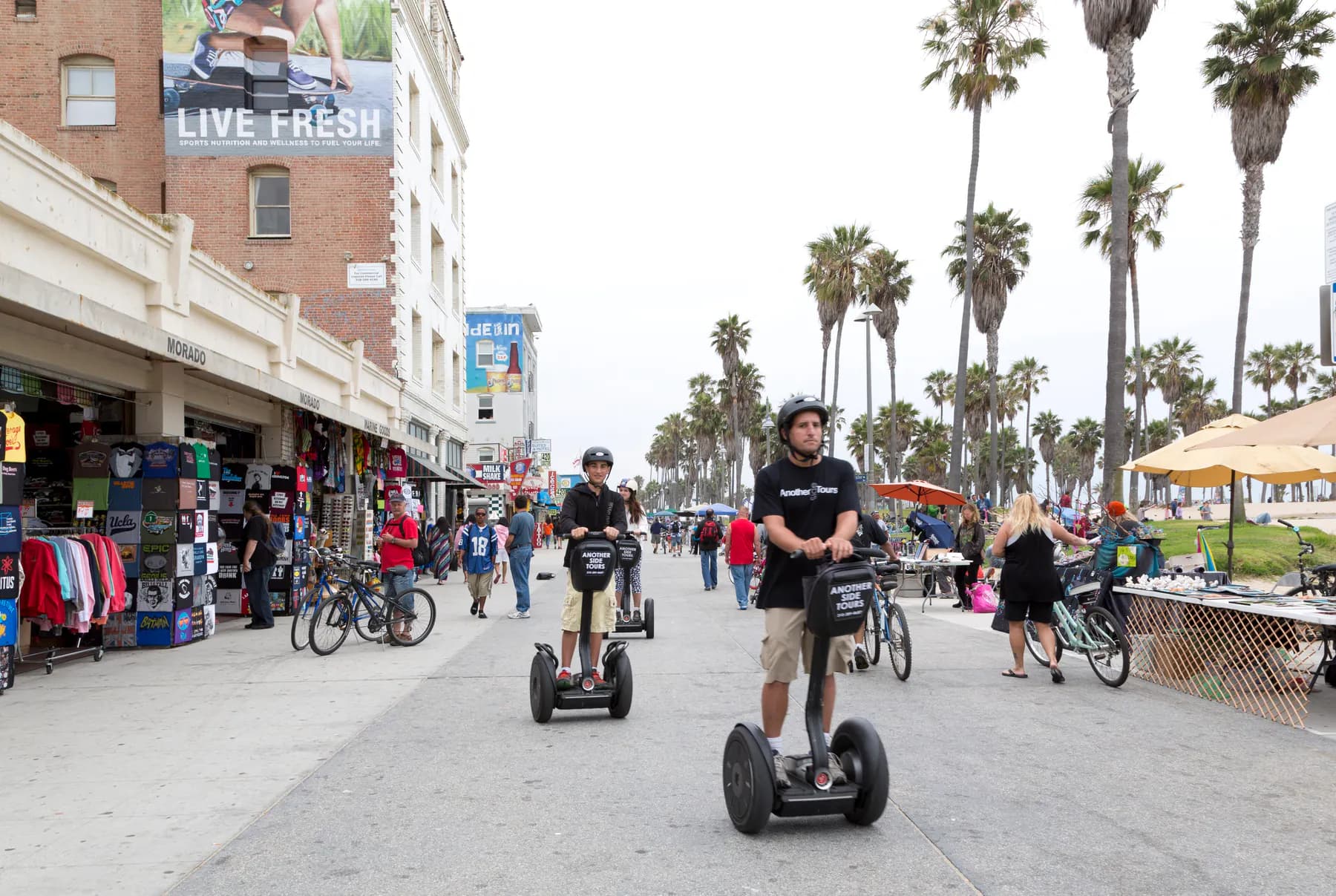
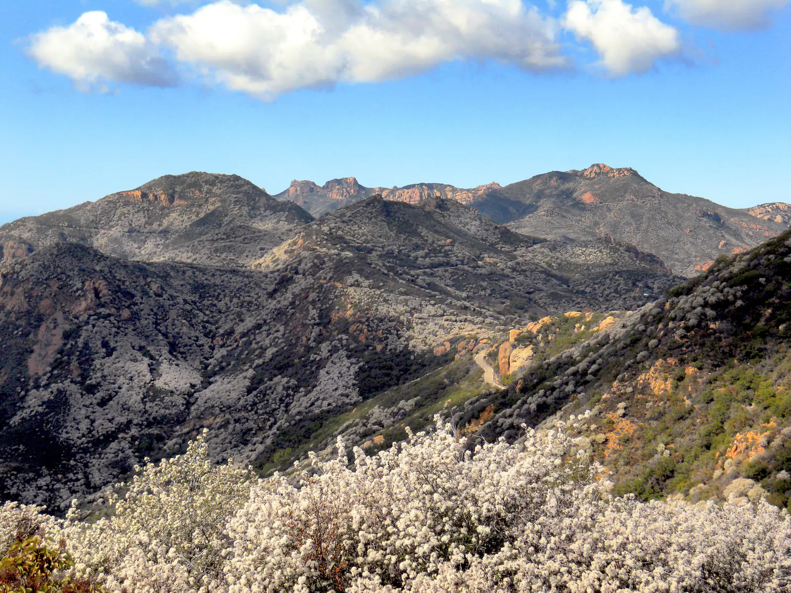
These photos show local places. They do not prove a boundary, service condition, hazard, readiness, or public position.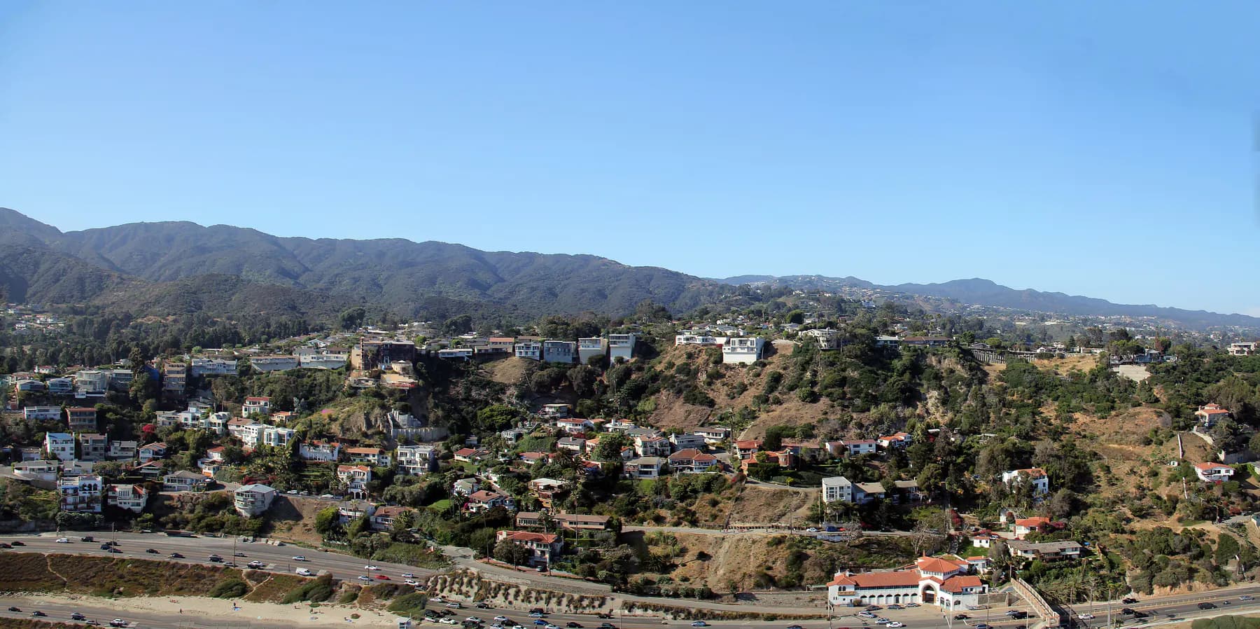
Illustrative boundary map
Select an area, show or hide map details, zoom the illustration, or follow the guided tour. The map raises questions. It does not propose a legal boundary.
The same information in text
The possible areas, map details, unresolved choices, independent neighbors, and service questions are listed here without requiring the visual map.
Six Community Plan Areas help residents discuss places. They are not a legal or property-by-property city boundary.
The shaded areas keep LAX and Bel Air / western hills visible as open questions. They do not show included or excluded territory.
Existing neighboring municipalities are shown outside the working concepts and remain independent governments.
Lines show where service responsibilities need answers. They are not service areas, routes, or connected systems.
Coastal, hillside, watershed, heat, earthquake, and access labels show questions to answer. They are not hazard or infrastructure data.
| Area reference | Description | Questions to answer | Action |
|---|---|---|---|
| Brentwood–Pacific Palisades | One possible area spanning coastal and hillside neighborhoods. Emergency access, evacuations, roads, utilities, and coastal access would need careful review. | Wildfire and evacuation plans; Hillside roads and coastal facilities; Reliable service across the area | |
| Westwood | One possible area centered on Westwood’s homes, businesses, schools, and medical institutions. Service demand and responsibility across those institutions remain open questions. | Working with independent institutions; Traffic, streets, and public space; Demand for city services | |
| West Los Angeles | One possible area linking residential and employment districts. Its exact edges, neighborhood representation, and service responsibilities have not been decided. | Services along major streets; Neighborhood representation; Road and facility maintenance | |
| Palms–Mar Vista–Del Rey | One possible area based on an existing Los Angeles planning area that includes Palms, Mar Vista, Del Rey, and Playa Vista. A planning area is not a proposed city boundary. | Easy access to everyday services; Street and utility condition; Whether these neighborhoods belong together | |
| Venice | One possible coastal area. Residents would need clear answers about public spaces, beach access, transportation, street cleanliness, and preparation for floods and heat. | Beach and coastal access; Clean and safe public spaces; Flood and heat preparation | |
| Westchester–Playa del Rey | One possible area south of Ballona. LAX is shown separately because no decision has been made about whether the airport could or should be part of a proposal. | Working with airport authorities; Coastal and earthquake preparation; Emergency access |
Boundary status: The maps are illustrations, not legal or property-by-property boundaries. No boundary is settled. A lawful proposal would require detailed property, service, financial, and environmental review through LA LAFCO, the county agency that reviews proposed city boundaries. Whether LAX or Bel Air / western hills belongs in any future boundary remains unresolved. Existing cities shown nearby are independent governments outside the possible territory.
Unresolved boundary choices
Turn the LAX and Bel Air / western-hills areas on or off to see how the questions change. No view says that either area is legally included or excluded.
The same comparison in text
The maps are illustrations, not legal or property-by-property boundaries. No boundary is settled. A lawful proposal would require detailed property, service, financial, and environmental review through LA LAFCO, the county agency that reviews proposed city boundaries.
The illustration shows six Community Plan Areas to help residents discuss places. It does not decide whether LAX or the western hills would be included or excluded.
Information needed:Official property records, community ties, services, infrastructure, costs, environmental review, current law, LA LAFCO requirements, and public review.
The Bel Air / western hills area is shaded only to show how the questions would change. The area remains unresolved. It is not claimed as included or excluded.
Information needed:Official property records, community ties, wildfire and evacuation conditions, hillside infrastructure, service responsibilities, legal review, and public discussion.
The LAX area is shaded only to show how the questions would change. The initiative does not claim that LAX is included or excluded.
Information needed:Specialized review of law, land, governing authority, public property, airport operations, security, costs, obligations, services, and regional effects.
Both unresolved areas are shown at once so residents can see the unanswered boundary questions. This is not a combined proposal or finding that a city is feasible.
Information needed:Separate and comparative review of property records, law, costs, services, infrastructure, environmental effects, governing authority, fairness, and the public process for each area.
Services and emergency responsibilities
Choose a topic to see which public agencies, service questions, and records might matter. This is not a service-area map, infrastructure record, dispatch tool, or live system.
Choose a public-service question
For an emergency, call 911 and use alerts and instructions from official public agencies. This page cannot dispatch help or issue alerts.
The same information in text
This initiative is not connected to any police, fire, EMS, 911, utility, or agency system. Any future connection would require legal authority, written agreements, privacy and security protections, and emergency coordination agreements. The lines in the illustration show questions only.
Questions about who has authority, who dispatches help, how warnings and mutual aid work, how information stays accessible, and how services continue. This does not show coverage, command, a response zone, or a connected alert service.
Verification requiredEmergency: Call 911 and use official agency alerts. No systems are connected.
Questions about daily travel, disability access, road responsibility, evacuation, and trips across city lines. This illustration has no traffic, route, transit, or travel-time data.
Verification requiredQuestions about ownership, condition, capacity, service continuity, legal authority, and connections. This is not a utility map and shows no public property, lines, providers, capacity, or service areas.
Verification requiredQuestions about resident needs, maintenance, responsible decisions, and public records. This is not a work-order system, public-property list, maintenance route, or service commitment.
Verification requiredQuestions about hazards, people who need extra help, lifeline services, preparation, uninterrupted service, and recovery. This is not a hazard map, evacuation map, forecast, facility plan, or finding that a city is ready.
Verification requiredThe map asks where agencies and services might matter. This diagram asks who should take responsibility, what residents should be told, and what records should be public. It does not show a working city service.
Choose a city responsibility
This illustration asks who could be responsible at each step. It does not show live information, a provider commitment, facilities, current service, or a connection to any government or utility system. This initiative is not connected to any police, fire, EMS, 911, utility, or agency system. Any future connection would require legal authority, written agreements, privacy and security protections, and emergency coordination agreements.
For an emergency, call 911 and use alerts and instructions from official public agencies.
This asks who would handle an urgent need, who has lawful authority, who responds, how agencies work together, and what the public is told. It is not dispatch, coverage, command, or an alert service.
Need / responsibility question
Official intake would have to distinguish emergencies from non-emergency requests and provide accessible alternatives. This concept does not receive requests or summon help.
| City responsibility | Resident need | Accountable staff decision | Service delivery | Work across city lines | Public record |
|---|---|---|---|---|---|
| Emergency responsibilities | Official intake would have to distinguish emergencies from non-emergency requests and provide accessible alternatives. This concept does not receive requests or summon help. | Dispatch, command, triage, accessibility, and public-warning decisions must remain with verified responsible agencies and authorized staff. | Police, fire, EMS, shelter, warning, and service-continuity roles would require confirmed providers, capacity, standards, and backup plans. None is claimed here. | 911, mutual-aid, hospital, county, state, utility, and neighboring-jurisdiction handoffs would require verified authority, agreements, exercises, security, and responsibility. | Incident and public-information records would require lawful privacy, retention, accessibility, correction, and disclosure rules managed by responsible agencies. |
| Transportation responsibilities | Accessible channels would need to distinguish maintenance, safety, transit, curb, sidewalk, bicycle, freight, and emergency-access needs without forcing digital access. | Verified street, transit, planning, accessibility, and enforcement authorities would need transparent roles and criteria for each request type. | Responsible entities, assets, standards, funding, ownership, schedules, and maintenance duties would need authoritative confirmation before any service promise. | Travel across city lines would require confirmed agency roles, agreements, fare or funding rules, authority over roads and sidewalks, and disruption plans. | Public records would need to distinguish requests, decisions, projects, disruptions, source dates, geography, responsible entities, and correction paths. |
| Utility responsibilities | Official channels would need to route safety, outage, billing, access, quality, and infrastructure needs to the verified responsible utility or regulator. | Authorized utility, regulatory, public-health, emergency, and local roles would need clearly separated decisions, standards, appeals, and escalation paths. | Ownership, service areas, assets, condition, capacity, workforce, contracts, affordability, and continuity duties would require current authoritative evidence. | Water, power, gas, communications, wastewater, watersheds, and emergency needs cross city lines. Each would require confirmed agency responsibilities and backup plans. | Records would need lawful security and privacy boundaries while publishing accountable decisions, performance definitions, source dates, outages, investments, and corrections. |
| Public-works responsibilities | Residents would need accessible channels for streets, sidewalks, drainage, trees, waste, lighting, facilities, and other verified public-works responsibilities. | Named public staff would need lawful, inspectable criteria for urgency, accessibility, safety, equity, condition, lifecycle, budget, and appeal. | Verified departments, utilities, contractors, owners, standards, workforce, procurement, inspection, and funding would control delivery; none is represented here. | Watersheds, major roads, utilities, waste, public rights-of-way, emergencies, and neighboring cities would require clear responsibilities and public agreements. | The public record would need to connect requests, decisions, inspections, costs, contracts, work status, source records, responsible parties, and corrections. |
| Preparation, service continuity, and recovery | Preparedness and recovery channels would need to account for disability, language, housing, transportation, health, digital access, pets, and other verified community needs. | Responsible emergency, planning, infrastructure, public-health, environmental, and community roles would need verified authority and accessible decision rules. | Warnings, evacuation, shelter, continuity, mitigation, lifelines, and recovery require official providers, facilities, capacities, triggers, plans, exercises, and fallback evidence. | Hazards and lifeline services cross city lines, so county, state, federal, utility, health, watershed, and neighboring governments would need confirmed roles and joint exercises. | Public records would need dated sources, plan versions, exercises, after-action findings, corrective actions, privacy protections, accessibility, ownership, and revision rules. |
Emergency and service warning: This illustration cannot contact a provider or agency, accept a service request, dispatch help, control infrastructure, report current conditions, or issue an alert. For an emergency, call 911 and use alerts and instructions from official public agencies.
Regional relationships
Existing cities around the area are independent governments and remain outside the possible city. Future cooperation would need public review and agreements. None is claimed here.
| Municipality | Shown as | Coordination to study |
|---|---|---|
| Santa Monica | Independent municipality | Regional services, mobility, shoreline and emergency coordination |
| Culver City | Independent municipality | Mobility, infrastructure, watersheds and mutual aid |
| Beverly Hills | Independent municipality | Regional mobility, public safety and service coordination |
| West Hollywood | Independent municipality | Regional mobility and service dependencies |
| Malibu | Independent municipality | Coastal resilience, wildfire readiness and mutual aid |
Information residents would need
Choose one of six public questions to see which official records and independent checks would be needed. A mark means the information would be required. It does not mean the work has started, the information has been obtained, or the proposal is feasible.
Choose a question
A filled cell means that type of information would be needed to answer the question. It does not mean the information has been gathered, work has started, a city is feasible, or any review is complete.
Use official property, jurisdiction, public right-of-way, land, planning-area, and service-area records rather than tracing an illustration.
| Public question | Official property and boundary records | Current law and authority | Service and infrastructure records | Money, public property, and obligations | Community, fairness, and access | Safety, environment, and recovery | Clear, accessible public records | Independent and public review |
|---|---|---|---|---|---|---|---|---|
| Where could a boundary go? | Would be required | Would be required | Would be required | Would be required | Would be required | Would be required | Not listed for this question | Would be required |
| Incorporation process | Would be required | Would be required | Would be required | Would be required | Would be required | Not listed for this question | Would be required | Would be required |
| Service continuity | Not listed for this question | Would be required | Would be required | Would be required | Would be required | Would be required | Would be required | Would be required |
| Could the city afford its responsibilities? | Would be required | Would be required | Would be required | Would be required | Would be required | Not listed for this question | Would be required | Would be required |
| Would emergency services protect everyone? | Would be required | Would be required | Would be required | Not listed for this question | Would be required | Would be required | Would be required | Would be required |
| Would City Hall be accessible and accountable? | Not listed for this question | Would be required | Would be required | Would be required | Would be required | Would be required | Would be required | Would be required |
Local places
View credited photos of the coast, public spaces, major institutions, transportation, the airport, hills, and neighborhood streets. The images show local places. They do not prove a boundary, service level, public opinion, or readiness.
Coast / Pacific Palisades context
Any decision about the coast and hills would need to address terrain, access, evacuation, habitat, and infrastructure. A photograph can show a place, but it cannot settle a city boundary or show whether services are ready.
The coast near Pacific Palisades. This photo does not establish a boundary, property line, access condition, hazard, or current condition.
All photo credits and modificationsWhat these photos show: The photographs show local places only. They do not establish a city boundary, current service level, recent hazard, feasibility, public support, agency participation, or settled territory.
The maps are illustrations, not legal or property-by-property boundaries. No boundary is settled. A lawful proposal would require detailed property, service, financial, and environmental review through LA LAFCO, the county agency that reviews proposed city boundaries. Community Plan Areas and Neighborhood Council areas can help residents discuss places, but neither establishes a city boundary.
Review sources and photo credits